

奧頓 3 星級飯店
 改變心意預訂可以免費取消的飯店
 精挑細選搜尋全球約 100 萬間旅宿
查看奧頓 3 星級飯店的供應情況
奧頓 3 星級飯店的精選推薦


7.8 分,滿分 10 分,不錯哦,(319 則評論)
「Owner was having a baby so lobby and restaurant were closed. Check in info was in an envelope by the door. After a 10 hour drive and no nearby restaurants thank God I had a couple cans of soup to heat up in the microwave. Our room was called the "Ice Cave" fitting since it was so cold! Room was so small it was claustrophobic. Congrats on the baby, but have back up to run the hotel please.」

Suzan


9.6 分,滿分 10 分,好極了,(91 則評論)
「I found this property very charming. While we had to leave to early to get the included breakfast, we were very impressed with all the amenities and the property. Now, one thing that may throw people off is that the property owners are very hands off and only show up during breakfast hours. I personally like it as they treat you as an adult, and in return you have pretty much free rain around the property as long as you don’t bother the animals. You will have to travel for food, but they...
Brian
現在價格為 NT$4,665
總價 NT$6,652
含稅金和其他費用
8 月 4 日 - 8 月 5 日


10.0 分,滿分 10 分,好極了,(1 則評論)
「Lance, our host with LKChalet, communicated great before and after our stay ensuring everything was ready. When I asked if there was an iron and ironing board so we could touch up clothes for a wedding he went out and got one so it was there when we arrived. The welcome basket was an added bonus. Being the first guests at the LKChalet and this being our first trip in something other than a hotel couldn’t have gone better. The location, accommodations, surroundings, and host service made this...
Richard


進一步了解奧頓
盡情探索奧頓的健行、野生生態和探險活動等活動!

相片來源:Eric & Kristy's Adventures
相片來源:Eric & Kristy's Adventures,開源相片
熱門奧頓飯店的評分
深入了解奧頓
口袋指南:奧頓3 星級飯店
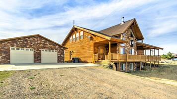
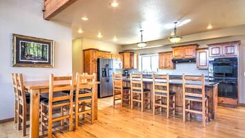
奧頓 奧頓, 猶他, 美國 的頂尖 3 星級飯店大受歡迎,原因顯而易見:飯店設施齊全,環境舒適,服務貼心獨到,且房價折扣與優惠皆為同地區最低!只要預訂奧頓 3 星級飯店,您即可在店內餐廳、雞尾酒吧、完善的健身中心與寬廣的客房內,品味渡假旅程中的小確幸。
若想享受優雅渡假體驗,奧頓 的 3 星級高檔飯店超值優惠最適合您;想展開平價旅程,您則可任選奧頓景點附近的 3 星級平價飯店,盡享最佳性價表現的住宿。無論您採取哪種旅遊方式,都別忘了善用 Expedia 智遊網的搜尋工具比一比價格,了解在地設施,並搜尋本地折扣優惠!
從商務差旅到家族旅行,奧頓 3 星級飯店都可成為您旅程中的完美落腳處